8 over 7 Bikepacking Adventure
8 over 7 North to South
Idea: to complete the 8 over 7 Course (summit all 8 peaks in the Black Hills over 7000 feet) and to do it by bike in a solo, self-supported style.
Morning of Day 1:

Wake up at 4:00, wake up Muira at 4:45. On the road for a little over an hour to the summit of Terry Peak (Peak #1 of 8). Feeling very nervous and excited.
Muira waits as I climb to the top of the tower and take a video. Back down the stairs to her and my car and my heavily packed bike and the beginning of an adventure.
Then a magical moment: Muira gets out of the car to take a photo of me and my bike and then asks, “Why do you do things like this?!!” And I get to answer her and hope she really, really hears me…or, at least some day she will remember what I say. I tell her, “Because attempting anything difficult, no matter the outcome, creates a sense of confidence, of joy, and meaning. Even if the thing isn’t accomplished its the effort and the trying that make you really KNOW you can do anything in life…and that feeling and sense of yourself creates a life worth living.” She probably rolled her eyes… I don’t know…haha…but that’s okay. I believe as her model in this life, she will eventually do her own difficult things that bring her joy.
For those of you who like the deets on all this bike packing stuff….
I am riding a hard tail with 29 x 2.2 tires and drop bars. A bike made for bike packing.
I’ve converted my bike with attachments so I can now take along:
-140 oz of water at one time although my water filter was still packed “just in case”.
-I also over-pack my food as it gives me comfort :-).
Also…
-one-person ultra light tent with no ground cloth
-small sleeping pad
-kid’s sized sleeping bag (I’m small and a kid’s size sleeping bag means less weight!)
-gun
-puffer jacket, a rain coat and pants, a light weight, long sleeve merino wool shirt and thermal underwear, a pair of light weight shorts, a thin neck gator, riding gloves, helmet, sunglasses
-TP, wet wipes, small baggies
-lightweight cup and spoon
-bike light, Garmin Edge 830, phone, extra charger and cord
-photo copied maps
-patch kit, other bike tools, extra zip ties, small amounts of duct tape
-a few hand/feet hot packs
-small knife
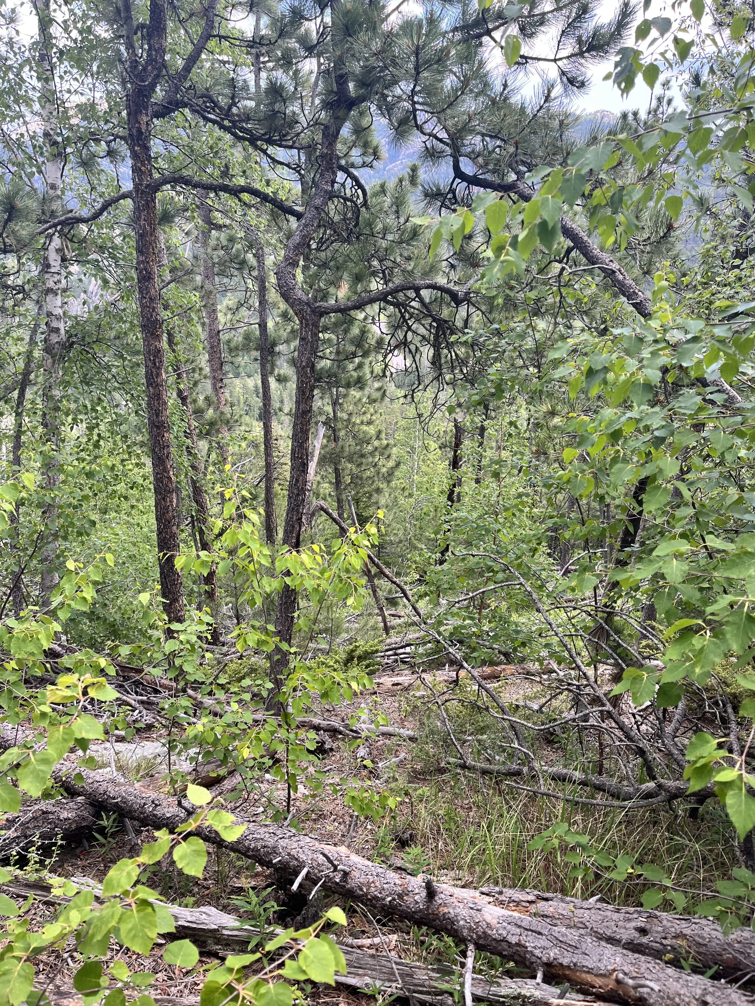
After cruising down beautiful highway 85 I take my first turn onto a road I wasn’t expecting. A very “off-road” road. I had assumed this would be a gravel road when I looked at the map. I made the decision to do this route super last minute so didn’t have a lot of time to plan or look at the route that I had uploaded from a friend so I kind of went into things blind….which is good and bad. Bad because I was not prepared for the type of riding I was about to do…good because I didn’t know the type of riding I was about to do! Ha ha!

After wrestling to get the gate open and then shut behind me, I am off again and bumping over rocking, grassy, muddy terrain. Then, another gate. This one is very difficult to open but I win eventually. Onward. To another gate. Eye roll. But this one is closed. Really closed. In fact maybe I’m not supposed to be on this road but this is where my Garmin was taking me and I really, really don’t want to back track all that stuff I just rode. Right or wrong, decision made. My bike is too heavy for me to lift it over the barb wire so I spend about 20 minutes canvasing the fence to see if I can get through. Eventually I am able to find a spot where I can lift up the bottom barb wire to pull my bike under it. I am now in waist deep grasses and soaking wet. Luckily I have my rain pants on already but my shoes and socks and feet are drenched. This is hour 2. Feeling a bit down. Onward with wet feet.
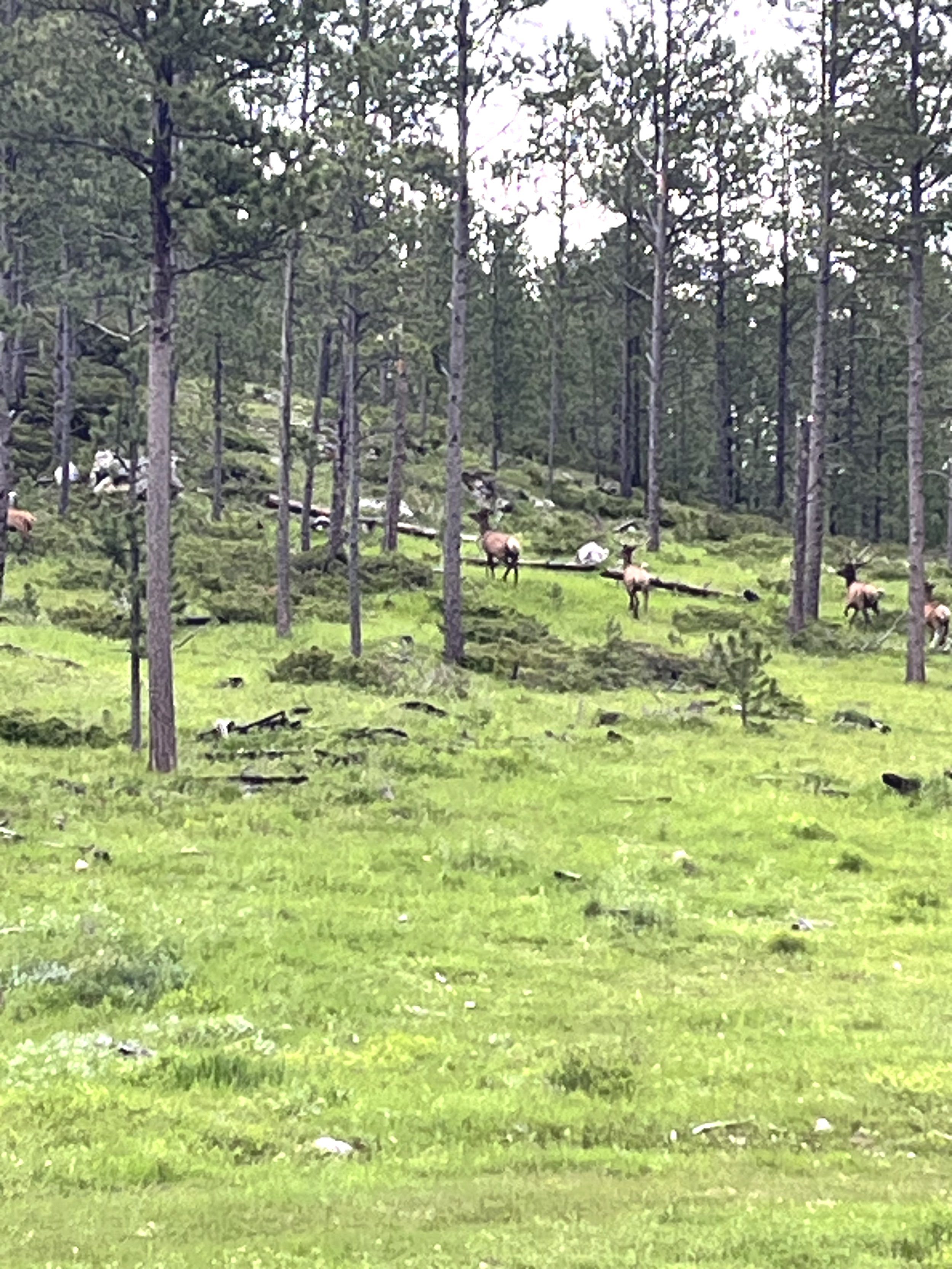
Right before I arrive at Crook’s Tower (Peak #2 of 8) I am met with a heard of Elk rising out of a misty morning meadow, crossing directly in front of me. I stop and reach for my camera. They startle and run up the hill. The word I use to describe elk is majestic. They are majestic creatures. If you haven’t seen one, I hope you have the opportunity at some point. Feeling awe.
Back riding towards Crook’s Tower. This one is easy to find as the love of my life proposed to me on this spot almost exactly a year ago. I linger a little longer here at the summit to relive that memory and lovely feelings. But only for a moment and it’s time to get going again. Feeling loved.

Next up is Crow’s Nest Peak (Peak #3 of 8). I heard this one is difficult to find. After traveling for a time, I take a left hand turn and assume the peak on my right is Crow’s Nest. Side note: my assumption of peaks and that they are what I’m looking for will prove to be a time-taking, extra-hiking, losing-energy fiasco although this assuming does allow me to summit a few extra peaks/hills along the way that I probably would never, ever had experienced. So there’s that.
Crow’s Nest is actually further down the road. I park my bike. My Garmin Edge says nothing about getting to the top so I go off the little research I did and what others who have been there have written: “It’s covered in down fall.” “No trail.” “Not fun.” “You can’t even see anything at the top. You’re just in the middle of a forest.” “If you can find a fence line, you can follow that to the top where the marker is.” I take my phone out of airplane mode (always need to save as much battery as possible!) and realize I have service! Yes! I load the peak into google maps and now can start walking towards the red point. I head in that direction while navigating through a tangled mess of downed trees, branches, bushes. I am actually videoing this because it’s so bad and I want to give Luke proof of my reality when I look up from my camera and….THERE’S A FENCE!!!! YES!!! I bushwack my way up and along the fence line while simultaneously trying to get my blue dot to overtake the red point on google maps. Eventually I arrive. There is a marker but otherwise this peak is non-descript. You really are just standing in the middle of the forest.

As I start to descend I check the weather (I have service, remember?!) and riding through these hills you can never really tell what’s on the horizon. Plus, I didn’t check the weather for today because obviously it’s going to rain (seems like it’s been raining every single day this spring/summer) and I didn’t want to see that and psyche myself out. It’s just better for my mind if I don’t know. But I sense something is coming so I look. Radar indicates severe thunderstorms and lots and lots of rain in about 2 hours. This gives me 2 hours to get to The Deerfield Lake store (my re-supply for water). Okay. Good. Feeling relieved.
Two minutes pass and now it’s raining. Feeling less relieved. It’s a few drops here and there at first but now on the descent the rain is really getting going. I get back down to the muddy two-track, pass through a gate and I’m on my way to Deerfield lake in pouring rain. It does not stop and the thunder and lightning start up. In my tired mind, it seems like the lightening part of the storm is trying to chase me down. This makes me feel like I have to keep pushing hard on my bike to stay safe. And this is a problem because I’m not paying attention to my garmin, just my efficiency of my pedal strokes. And I am now about 5-6 miles south of where I need to be in order to hook up with Deerfield Road… in pouring rain, soaked shoes and feet (I took my socks off hours ago to try to dry them on the front of my bike as I ride…yeah, right!) and my rain jacket is not doing what it’s supposed to do. This is when going solo can really be a problem. Navigation is huge and without another brain to help with it, it can really break down. And I’m starting to get really cold. Feeling afraid and defeated.

I regroup myself (because what else are you going to do out here!) using my Avenza app (if you get out in the woods a bit, I highly recommend this app!! This app has saved me so many times on adventures like this!!) These are maps you pre-download and then anywhere you are, whether you have service or not!, you can see exactly where you are on the map. So using this, I backtrack to where I was supposed to make a turn. Okay. Just pretend you didn’t go 10 miles out of your way. Don’t think about it. Just move and keep moving. Just move.
So I move. And the rain starts coming down in literal sheets. I can barely see and I am now freezing. It’s hard for me to use my brakes because my hands are numb not to mention my soaking wet feet with no socks. And this is where the defeat takes over. Just get to the store and you can call and get picked up. Think of what a hot shower will feel like when you get home. Think about all the comfort. You can suffer for a little longer but then it can all go away shortly. You’ll call Muira and have her come get you. It’s okay. You tried and that’s all you set out to do. Decision made. Feeling disappointed.
I make it to the store and a miracle takes place. The owners turn on the pellet stove in the corner of restaurant seating area for me and encourage me to huddle up next to it and try to dry my things. They give me a huge hot chocolate and tell me I can stay for as many hours as I need. This is the best part of these trips…the kindness of others. It amazes me and gives me the gift of going through this world knowing there is more kindness than awfulness out there. I order a burger and fries, take off my wet gear and put in a call to Luke. He reads the radar for me and tells me it appears it will clear up around 5:00pm. It is now 2:00. Decision made. I settle in. My body slowly starts to warm. Feeling optimistic.
At about 4:30 the weather begins to break. I immediately gather my things and fill up my water bottles. My things are not totally dry (definitely not my shoes and socks!) but the sun is starting to peek around the clouds and I feel hopeful. I start heading in the direction of Green Mountain (Peak #4 of 8).
I travel now by sun rays….YES! It’s a whole new world to me in this moment. I am optimistic and ecstatic and I am peddling away! If I can make it to Green Mountain yet tonight, I will have done 1/2 of the peaks in one day and only 4 more tomorrow. To my utter surprise I might be able to wrap this up in 2 days if I want to push it a little. I think I want to.

I arrive at the intersection of Williams Draw and 1B. My garmin says to head down 1B to the top of Green Mountain so I begin to descend the rutted, muddy, slippery, baby-head-filled two track. And then the road starts to climb. I’m thinking: This sucks so bad. This can’t be right, can it? I’m so tired of pushing my bike! My feet are so wet. I wonder if something bad can happen to your feet if they stay wet all day. I bet they look like crazy prunes. Better stop and make sure you’re in the right place.
Now remember, I am exhausted. It is now about 5:30pm. It’s been a long day. My brain is not functioning correctly. Your brain just can’t if you’ve spent a day physically pushing your body. So I’m foggy. I pull out Avenza maps and check my location. Ugh! I’m totally off! I need to go back to where I was and Green Mountain was right at the beginning of the intersection. I also had notes that I had taken about summiting green Mountain. The way I just read them also indicates Green Mountain is back where I was. Alright. Fine.
I hike my bike all the way back to the intersection. I now decide I better set up camp for the night. It’s getting late and I’m exhausted. I take a bit to find a spot I believe no one will see me but that’s not too far off the road. Here’s where I start praying to God (actually, I had prayed many times before on this adventure and will continue to throughout!) that my sleeping bag isn’t wet…because that’s going to be a problem I’m not sure how to solve. Prayers answered! I get everything set up and decide to grab my water and a bar and quickly hike to the top of Green Mountain before the day is done.

Although there was no service at camp, there is at the top of this Green Mountain. I call Luke and let him know where I’m at and that I made it to the top of 4 of the peaks today. As I’m talking to him and looking around from my vista, I notice that there is a much higher peak off to the east a bit. F*&%! I quickly hang up and re-read my notes. I also load Green Mountain on Google Maps. F*&% me. I really need to get to this summit yet today as I know I won’t have it in me to do it tomorrow plus everything else I want to do. Remember things feel very emotional and real to me right now. I’m exhausted and not the sharpest knife in the drawer at this moment. Obviously I know this is not the end of the world ….but I really wanted that summit today. Feeling exasperated.
So back down to camp from whatever peak I am currently on. I grab more water and food and start to descend down the two track (again!). I get to the bottom of the draw and start the uphill part. It’s here that I get confused again. I can’t see anything down here so it appears Green Mountain is over there to the left. I get off the road and head in the direction of what I think is Green Mountain. I’m hurrying because I really do not want to be out here, away from camp when it gets dark. I ascend a hill/small peak. Again, this is not Green Mountain. But I can see from up here. Back to the two-track. I reread my notes…a part I missed before…it’s 2.2 miles one way to the top. Hmmm…okay. That seems like a lot to get done before the sun sets. But if I push my pace, I could make it. I look at Avenza maps and now it makes sense (I had looked at it upside down last time). I can now watch my blue dot get closer and closer to the point of the summit on the map. Feeling invigorated.
I climb and climb and finally reach a point where the road ends. Ahead of me is a field full of downfall, ground bushes, and probably snakes. Avenza tells me I need to start heading up through this mess to get to the actual peak. The sun is dipping lower and lower. I go through the downfall as quickly as I can being cognizant of snakes as well as not spraining an ankle. A skunk crosses my path about 10 feet in front of me. He thankfully carries on sans spray. I’m going as quickly as I can while sometimes looking behind me to make sure I know how to get back. Eventually I give up even trying. It all looks the same. Moving forward I hit a different 2 track. I take this to the absolutely astounding summit of Green Mountain. So worth it. Feeling awe.

But the sun is setting and I have to find my road to get back to camp. Avenza again. I can see the road on the map that I need to get to so I just start heading in that direction. It’s here that I start to panic a little. Seriously Heather. What are you going to do if you can find the road. You’ll never make it back to camp. You will be out of food and water. No one knows you came up here. Wait. Service up here so a quick text to Luke as to my time and location. Okay. Now someone will at least know where to look for me. I start praying (yes, as I said, this happens a lot!). Please help me to find the road. Please, God. And this gives me a bit more peace. I continue to concentrate on my map and direction it says I’m moving in in relation to the road. It’s frustrating but I know if I keep at it, I’ll find it. The sun sinks lower. And then, as I come over the hill, there it is…the road!!! Feeling elated and thankful.
I truck down the road as quickly as I dare to go with my wet feet and shoes and all the mud and rock. The sun has just set (so still some late evening light). I arrive at my camp-home. Feeling relieved. But now, the scariest part of this journey is about to happen. I have to sleep out in the woods by myself. This is my second time doing this alone. I succeeded my first time but it wasn’t an easy night. And this one proved to be similar. At first, I couldn’t fall asleep due to being anxious. What if there is a crazy mad-man who saw my tent and is going to torture and kill me? What if there is a really hungry black bear or mountain lion and they smell my food and rip me and my tent to shreds? (yes, these really are my thoughts). I slip in and out of restless sleep until at one moment in the middle of the night I swear I hear footsteps walking on gravel. I am half asleep but I know what I heard. I cock my gun and the steps stop. There is now about 30 minutes of me not moving and trying to hold my breath and strain my ears all at the same time. It’s towards the end of these 30 minutes that I have a few helpful thoughts that bring me some rest. It sounded like footsteps on gravel. I’m in the middle of trees and grass. I now also realize that when I breathe, the reverberation in my sleeping bag makes a sound sort of like foot steps on gravel. Okay. I don’t have time for this. If something is going to happen, it’s going to happen. Go to sleep. Feeling scared but too tired to care.
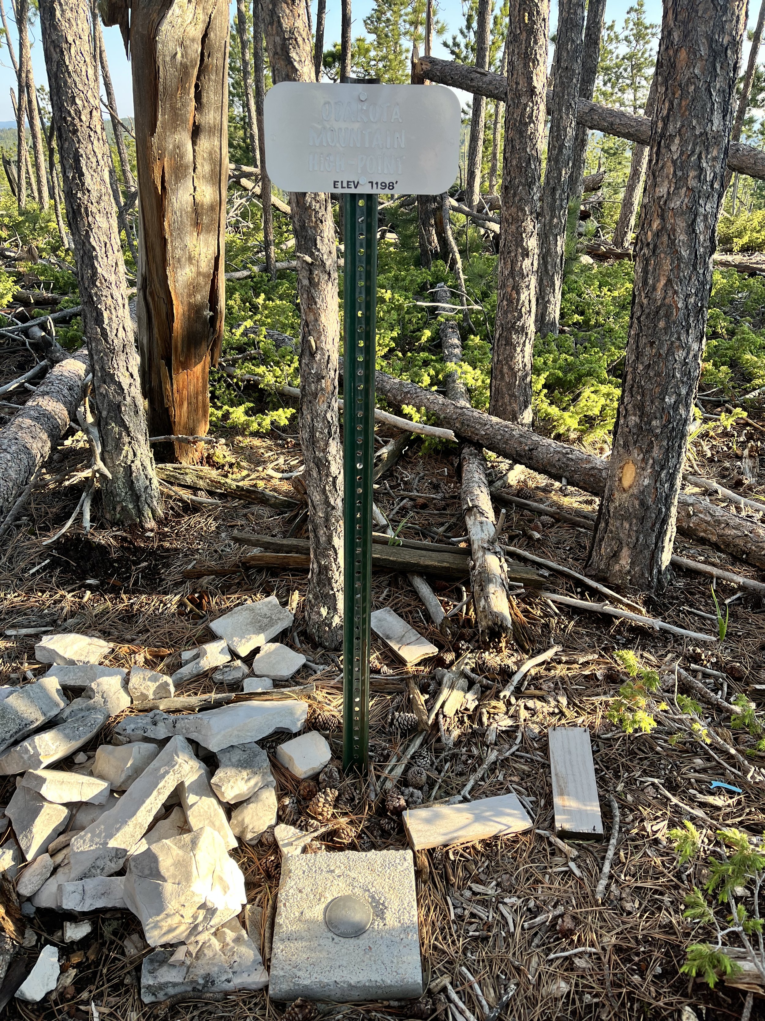
Day 2: The next morning I break camp as the sun slowly ascends over Green Mountain. It’s breath taking. I reroute myself after the Green Mountain fiasco and take off south on Williams Draw. Thankfully this is just a normal, smooth-ish, one-lane gravel road. I quickly arrive at Odakota Mountain (Peak #5 of 8) and quickly-ish (my quads are sore!) ride to the top and find the summit marker. Yes! That was faster than I predicted. Feeling capable. Now on to Bear Mountain.
My notes say Bear Mountain (Peak #6 of 8) is a Bear! Ha! So I know I’m in for some climbing. I rerouted myself again for the approach to the top of Bear Mountain thinking I was choosing wisely going off route of what the original route called for. I just wanted some roads that were not mud for once. Where my bike wasn’t stopping all the time due to mud building up between my tire and frame and then me having to dig it out with a stick. I was over it. So reroute to nicer roads. And they are. For a moment. I descend fast and quickly realize as I keep descending the longer the climb to the summit will be. I try to just enjoy the ride. Eventually it’s time to take a right hand turn and start to climb. This is not a nicer road. This is another muddy, rocky, water running down the tracks, slippery road. And it’s a bear of a climb. See what I did there?


It’s quite terrible. This is pretty much a whole hike-a-bike to the summit on the steepest, muddiest, slickest track while periodically cleaning off the stickiest mud you can imagine that stops my rear tire from turning. And then I take a wrong turn. I go up 1F instead of 1K. I don’t figure it out until I’m over a mile in. F**&! (Usually I swear in my head but this profanity was out loud and loud!) I turn back and get on the correct road. The ascending is so steep and crazy to me. Can I seriously, physically do this?! Feeling doubtful.
This is where a little experience comes in. I have done some difficult things so in these moments of wanting to give up, I’ve really trained my brain over time to think in ways that keep me going. In this instance I remind myself that the “governor” (part of my brain) wants to shut me down but that the governor is often wrong. We know from studies on athletes that that switch that is screaming to stop can be overridden by us and that we have waaaaay more in the tank than our brain fools us into believing. So I choose to think this because it is much more helpful to me in this moment. I also practice thinking things like: Once I’m at the top I will obviously get to go down. And I always feel refreshed again after a descent. I will feel really proud of myself. Maybe the ranger is at the top and I can climb the fire tower if they invite me. Thoughts like this create feelings of strength, courage and power. And those fuel my behavior to put one foot in front of the other and keep pushing the bike up hill. And…not gonna lie.…still feeling very, very eager to get to the top.
I win the battle and make it to the top. The ranger is there and she is interesting and kind. She tells me that because there’s not a huge group of people that I can come up to the top of the tower where she is on fire lookout duty. I get to meet her extra sweet pitbull named Ranger and we have a lovely chat about her life and decision to work this very interesting job. Again, I meet the coolest people on treks like this.

So what gets pretty funny here is that I see the road that I will be taking down the mountain. And it’s a normal, wide gravel road. I could have taken this road to the top if I had stuck with the original route. Joke’s on me. Feeling a little chagrined but also delighted with the decent I’m about to embark on. Onward to the last 2 peaks!
I have about 15 miles to Custer and I know this area fairly well. I am determined to stay off any more 2 tracks and stick to gravel. I mostly descend down on Limestone Road until it intersects with Upper French Creek which I take to to the highway and travel about a mile east to hit the little town of Custer. Rolling into town I am thinking about how I no longer need to navigate anything. I know the rest of this route: follow Sylvan Lake Road out of Custer (which I may have to walk some as body/legs have some niggling pains and this is a long, big climb), hike to the summit of Sylvan Peak then ride to the bottom of Black Elk Peak and hike to the top. I call Muira and tell her to plan to pick me up around 5:00pm at Sylvan Lake. I’m going to get this done today. Feeling relief.
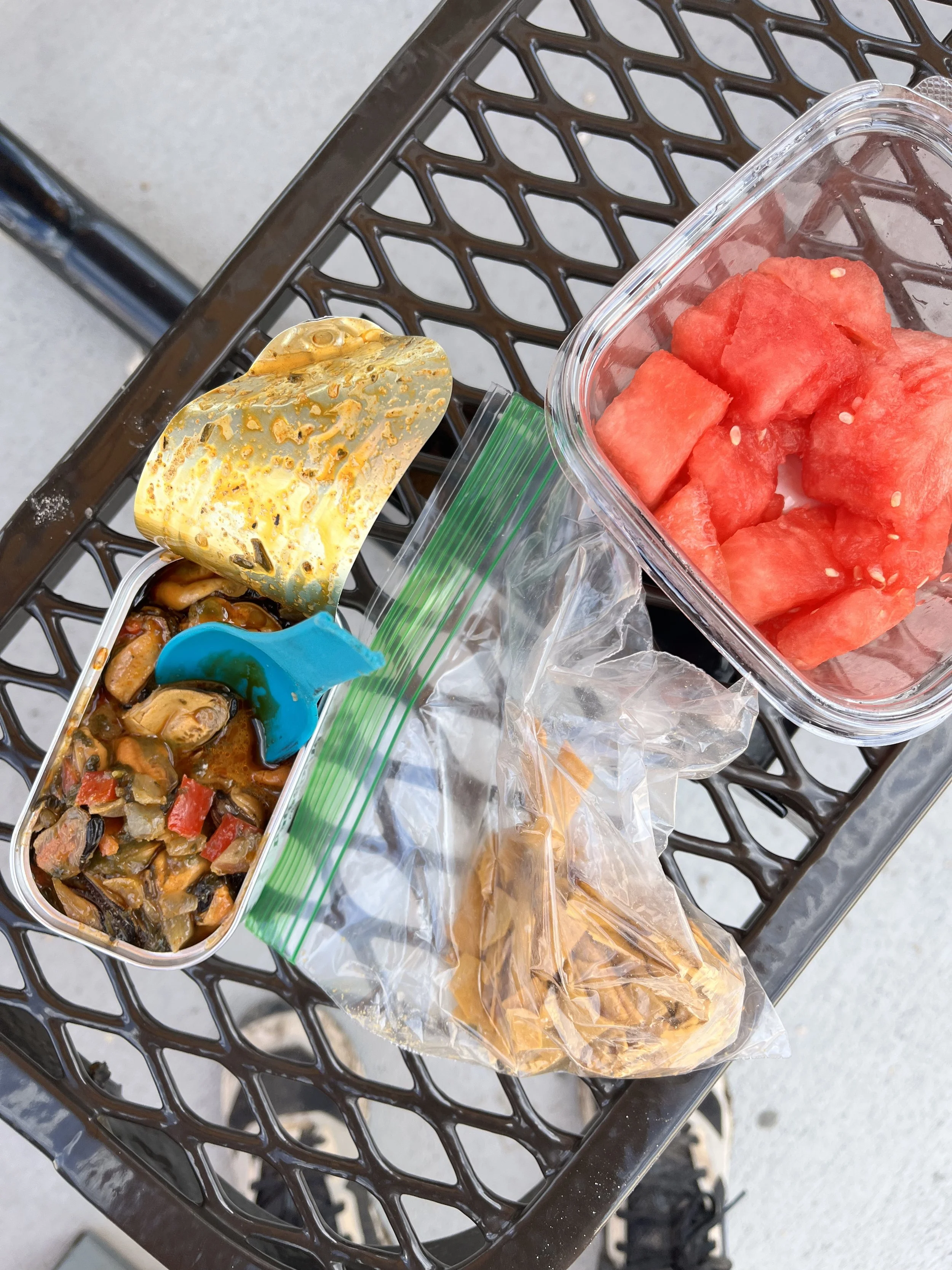
In town I stop at the picnic tables behind the Tesla charging station (which for some reason makes me happy that this is in little Custer) and I check over my bike. Its been squeaking like crazy and there was a lot of rattling on my descent. Nothing to be done about the squeaking…I’ll deal with that tomorrow. But I find the culprit of the rattling. Loose water bottle cage. I tighten things up and then I eat. I have saved some Patagonia Provisions Mussels and enjoy them now along with crushed up cheese crackers and watermelon that I just bought at the grocery store. The combo makes me so happy!
Side note: My goal for this trip was to stay properly fueled. I have a problem eating enough on these endurance events and my pace and performance and recovery really suffer. You actually don’t have much of an appetite and eating becomes a chore. But I’ve learned to force it because you feel so much better and have so much more energy and can go so much further and faster. Want to know what else I ate? If so, read the next bit. If you’re not interested, skip it :-)
Day 1:
* I first made sure I had 2 water bottles with @LMNT electrolytes always available and took along extra packets.
* In the car on the drive to Terry Peak I ate 4 oz of ground beef and 2 oz of shrimp along with a cup of coffee and an RX a.m. bar. Then throughout the day:
RX bar
2 Epic bars
1 Bobo’s Peanut Butter Chocolate Chip Bar
1 GoMacro Bar
1 Wild Raspberry Chia Squeeze
Burger and fries and a large hot chocolate at Mt. Meadow Store and Campground
1 White Chocolate Clif Bar
Hummus and crackers
Salami
3 mini Hershey’s Chocolates dipped in peanut butter
Day 2:
1/2 a caffeine pill (1 pill is 200 mg)
1 packet of Apple Cranberry Umpqua Oats made cold (I never bring a stove) mixed with 1 scoop @physivantage whey protein, creatine and powdered aminos and extra dried cranberries
1 RX a.m. bar
1 epic bar
I Bobo’s Peanut Butter Chocolate Chip Bar
1 White Chocolate Clif bars
Mussels mixed with the rest of my crushed crackers
Watermelon
Another Clif Bar
A protein cookie I bought in Custer at the grocery store
Another epic bar
Back to the adventure. I head up Sylvan Lake Road towards the start of Sylvan Peak (Peak #7 of 8) as threatening clouds start to gather around me. Rain on me. I don’t care. I’m almost done. This is really hard going but the food and the break helps as my legs don’t give out and I am able to stay on the bike. I arrive at the trail head and push my bike up some wide, grassy-green switch backs. I drop my bike and have a glorious moment of taking off my cycling/chamios “shammy” shorts and changing into my pair of light weight shorts. Glorious really is the word that comes to my mind. The only biking left to do is back down to Sylvan Lake and the beginning of Black Elk Peak! My butt is so happy!
I put on my rain pants (it’s hot but the brush is intense on this hike), grab a water bottle, a Clif bar and start the straight up section to Sylvan Peak I’m soooo thankful I have done this hike once before. There’s not really a trail, it’s really steep, there is treacherous downfall and there are 2 false summits so I know to go beyond what appears to be the top. I rush as I really want to finish… I’m tired and I don’t want to be late for Muira. My legs are aching. I’m definitely ready to be done. I keep climbing, navigating, reminding myself to pay attention because my brain is definitely not at it’s best. I keep turning around trying to get a picture of what I need to look for when I head back down. I finally make the summit as a large ominous thunderstorm begins to swirl directly above me. I quickly take a photo and immediately start heading back as the rain begins.

And this where things go very wrong. My brain just sort of stops working. All the sudden I am in a space I do not recognize. There is downed timber everywhere I look and every step requires me to step over or duck under a log. It’s exhausting. I traverse left for a long time. I recognize nothing. I traverse back. Nothing. I try to find the summit again. I can’t. I head back up hill for service. I call Luke. I’m lost. I’m sweating like crazy. I’m tired. I’m out of water and food and I seriously can’t find my way back. I’ve been trying for over an hour. He is calming and says he is headed that way as he was hoping to meet me at Sylvan Lake before I finish on Black Elk Peak. He says to try for the road and he can pick me up (no service down there so just stay on the road…I’ll find you). We hang up and I send him a screen shot of where I currently am at on Avenza so if I pass out out here someone has an idea where to look. I text Muira and tell her to come later than planned. And that’s when I remember (remember my brain is not optimal right now) that on Avenza when you zoom in you can see the direction you are walking. I can see the road on Avenza so I head in that direction as quickly as I can through the downfall everywhere. Remember the game Pick-Up Sticks? This is a giant’s version.
Here’s what I’m thinking: If you make it to the road somehow and he picks you up, you will not have done this solo and unsupported. You will have been supported. Ugh. That’s a hard one for me but if I have to I have to. Remember, you said this is about the effort, not the finale. If you need help you can take it and be okay. I keep plugging along. I see the road….way, way, way down below me. It’s like I’m on the edge of a cliff. Can I descend something this steep? Not smart but I’m not smart right now so I’m going for it.
The struggle is so real to get down. One of the steepest slopes I’ve descended hiking. Constantly trying to keep my ankles and knees safe as I’m cognizant enough to know how tired my body is and that’s when it’s easy to get hurt. To add to the steepness is the incredible overgrowth and underbrush and the real-life and real-big Pick-Up-Sticks. I’m stepping over things, I’m ducking under and through things. I’m scratched and bruised and I rip my rain pants. I remind myself to remind myself to check for ticks later. I see Amanita muscarias everywhere. Do you know this mushroom? They are spectacular! They are bright red with white spots. They remind me of the Smurf’s show I used to watch as a kid. I continue to slowly descend. I remember to pray. And, I’m not exaggerating, within 3 minutes I happen to look to my right, through all the brush and foliage and see bright green peaking through. Remember the wide grassy-green switch backs that I hiked my bike up?! I check for service. I still have it. I call Luke and tell him I’m good and will meet him at Sylvan Lake. Two hours of struggle and I’m back. I’m back. I’m back. I feel centered. I feel safe. Onward.
I get to my wet bike, helmet on and take off for Sylvan Lake Store to get more water, food and meet up with Luke before the very last leg of this adventure. He’s there shortly and sends me off with a quick kiss. I need to head out fast as the rain has abated but the thunder clouds are monstrous and surrounding Black Elk Peak (Peak #8 of 8).
And so, I start to walk. This is the longest hike but the blessing is I don’t have to navigate. This is a well-worn path so if I just keep moving, I can’t screw this up. I have blisters on my feet. I feel them…probably because they were wet all day long yesterday. They’ve worked really hard for me. My whole body has. It makes me feel gratitude. I also know it will need rest after this and I promise my body I will provide that. We have a talk, me and my body. We have an agreement. One more peak and then rest.
I always hope to inspire people (especially women) with my actions and my writing/words to do the things they’ve always wanted to do but feel scared and so don’t do the thing. I am here to tell you that I am always scared but I’ve practiced doing the scary thing anyway and that creates a life that feels joyful, satisfying, and lovely. I hope you try your scary thing.
And that’s how it ends. I get a tourist to take my photo at the top of Black Elk Peak. I descend. Muira pulls into the parking lot at the exact same time I do. She parks, gets out and says, “Good job, mom” and give me a hug. She asks if she can help load my bike. She drives me home and along the way asks me, “So how was it?”
The End


